| HYDROGRAPHY
|
|---|
Click on the Image above to see a larger sized image in a new window. The larger image produced is between 600 and 900kb in size and is an average resolution for the image produced by the FootPrints application. Larger or higher resolution monitors produce larger images. Single map images exceeding 5 Mb in size are not unusual. The FootPrints V2 interface allows you to size your mapping window to fit your needs. Full screen, small enough to allow multiple windows or anywhere in between the choice is yours. |
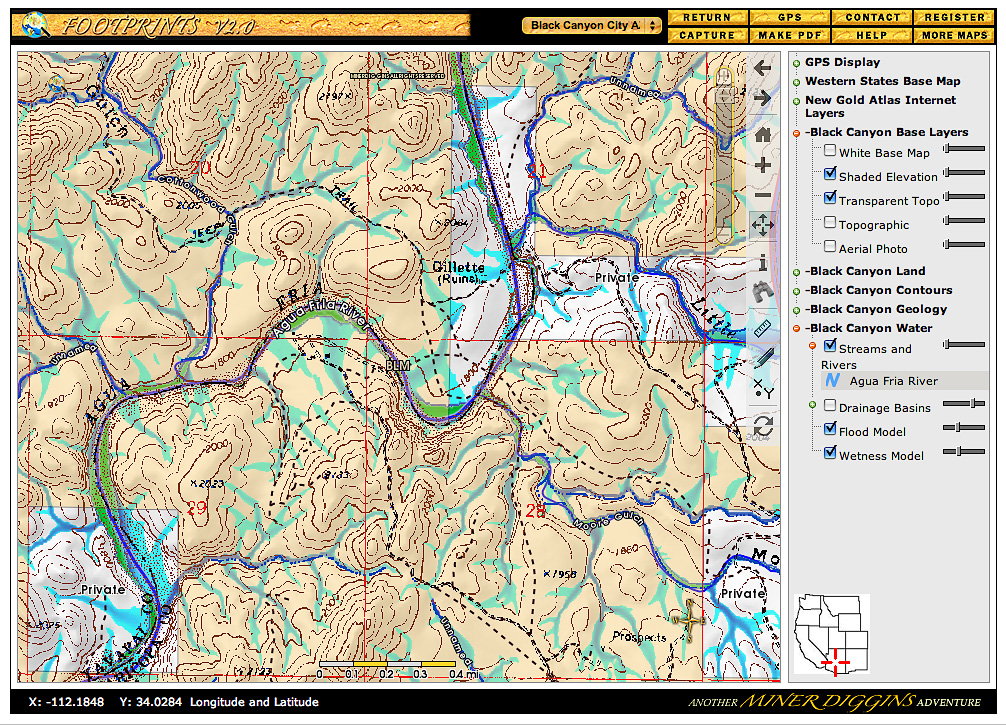
This sample map shows several of the Hydrography layers available in the Black Canyon City FootPrint. Four hydrography layers combine to provide comprehensive water flow display.
Basins, Flow and Wetness layers are transparent and can be overlaid on any base map. Here we have displayed three Hydrography layers over the Shaded Elevation map and added the transparent USGS Topo Map. Display them over the Ortho at full zoom to create another detailed water flow map. All hydrography layers are created by Miner Diggins especially for the Black Canyon City FootPrint.. Follow the water and Find the Gold ! |
|---|