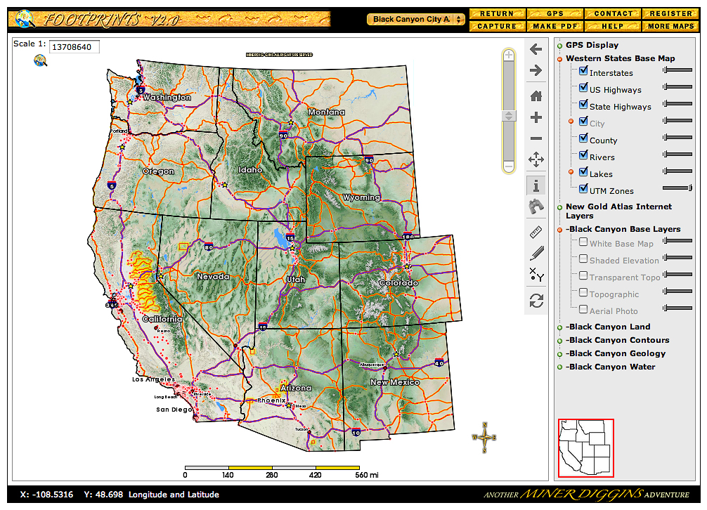
| OVERVIEW MAP
|
|---|
Click on the Image above to see a larger sized image in a new window. The larger image produced is between 600 and 900kb in size and is an average resolution for the image produced by the FootPrints application. Larger or higher resolution monitors produce larger images. Single map images exceeding 5 Mb in size are not unusual. The FootPrints V2 interface allows you to size your mapping window to fit your needs. Full screen, small enough to allow multiple windows or anywhere in between the choice is yours. |
The full extent of every FootPrints map is the entire Western United States. When a FootPrint is first selected from the dropdown "Select a Map" list at the top center of your mapping window you will be zoomed to the that specific FootPrint area As you zoom further in to the Black Canyon City FootPrint area, the roads and any mapping layers you select will be displayed in greater detail. The Overview Map also displays the FootPrints GPS layer. Any Tracks and Waypoints downloaded from your GPS may be displayed on this map.
|
|---|