| MINING CLAIMS
|
|---|
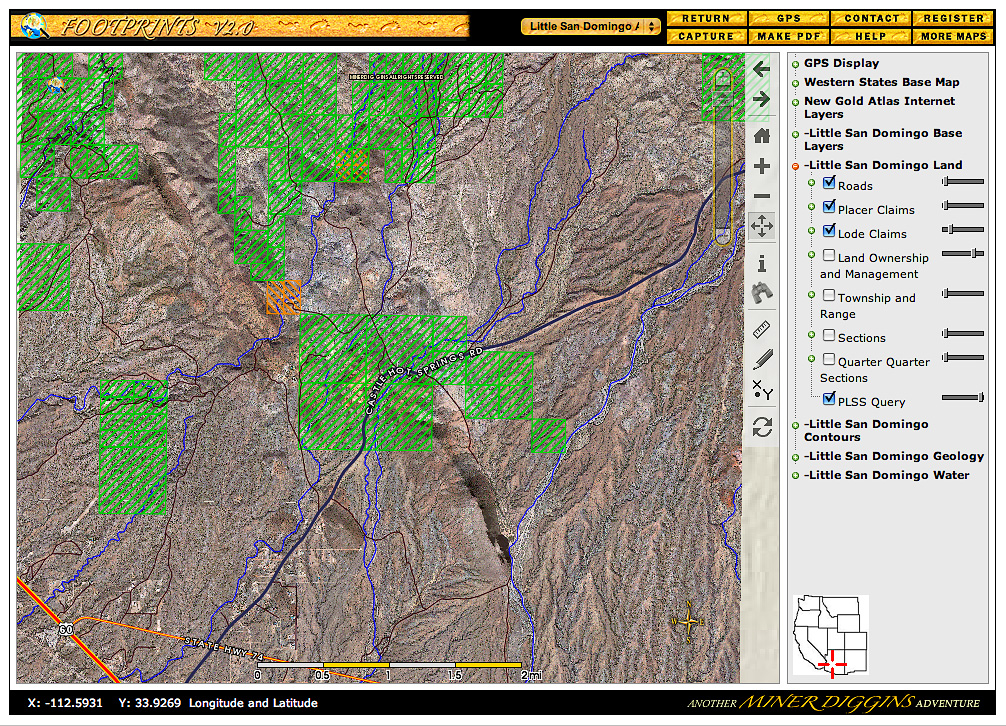
Click on the Image above to see a larger sized image in a new window. The larger image produced is between 600 and 900kb in size and is an average resolution for the image produced by the FootPrints application. Larger or higher resolution monitors produce larger images. Single map images exceeding 5 Mb in size are not unusual. The FootPrints V2 interface allows you to size your mapping window to fit your needs. Full screen, small enough to allow multiple windows or anywhere in between the choice is yours. |
This sample displays active Mining Claims in the Little San Domingo FootPrint at full extent.
This critical information is not available elsewhere. As you zoom into a particular area claim names will appear on the map. You can then research any specific claim by mapping it in numerous ways.
Add roads, washes, contours and hydrography layers.
Use with the Ownership Layer and the BLM Active Claims layer to help determine what lands are available to prospect and claim! Find a Spot and Stake Your Claim ! |
|---|