| FULL EXTENT OF MAP AREA
|
|---|
Click on the Image above to see a larger sized image in a new window. The larger image produced is between 600 and 900kb in size and is an average resolution for the image produced by the FootPrints application. Larger or higher resolution monitors produce larger images. Single map images exceeding 5 Mb in size are not unusual. The FootPrints V2 interface allows you to size your mapping window to fit your needs. Full screen, small enough to allow multiple windows or anywhere in between the choice is yours. |
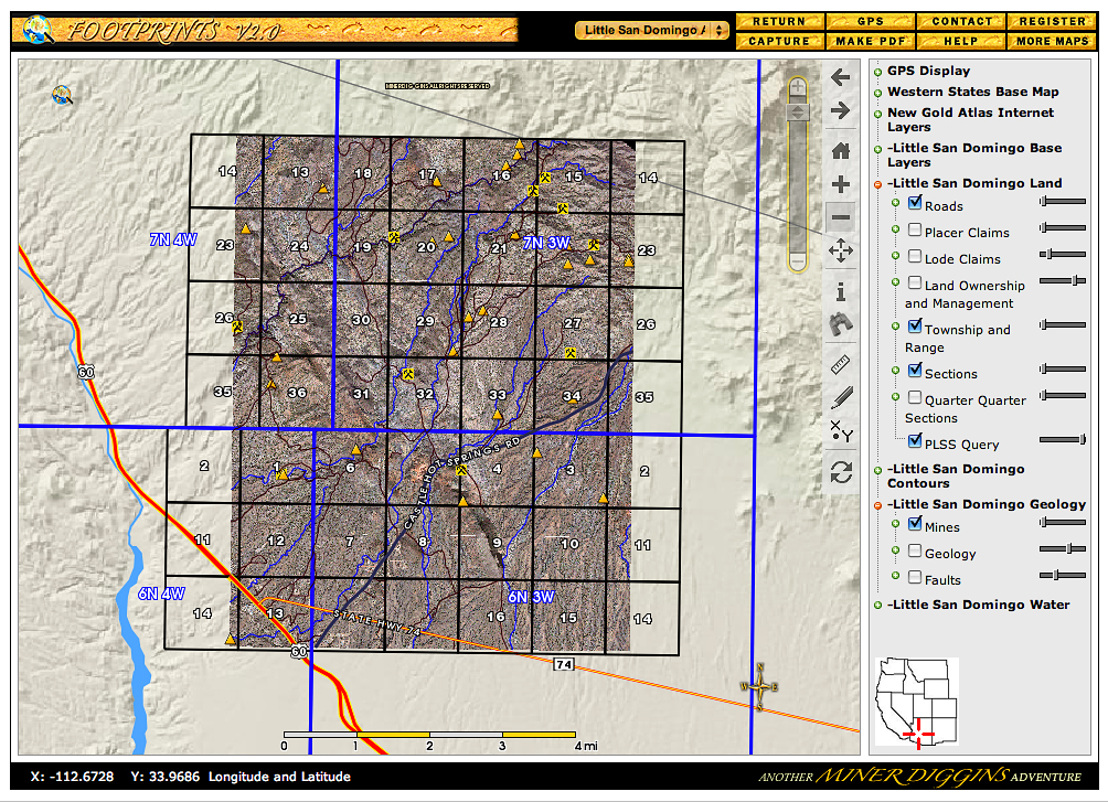
This Mapview shows the full extent of the area mapped in the Little San Domingo FootPrint.
This FootPrint shows the path of the Little San Domingo Wash from its source and stops just short of its outlet to the Hassayampa River. It also includes significant portions of San Domingo Wash, Ox Wash, Trilby Wash and Iona Wash
On the right side of the screen is a list of all layers that can be displayed on your map. In this example, we have selected these layers:
As you zoom into the map, more details will appear. You will begin to see Mine names and Wash names. By switching to Information Mode you may query the map to display the MRDS data for each mine. The MRDS is the USGS Mineral Resources Data System which catalogs known mines. This includes information such as commodity mined, previous mine names, references and much more.
|
|---|