| CONTOURS
|
|---|
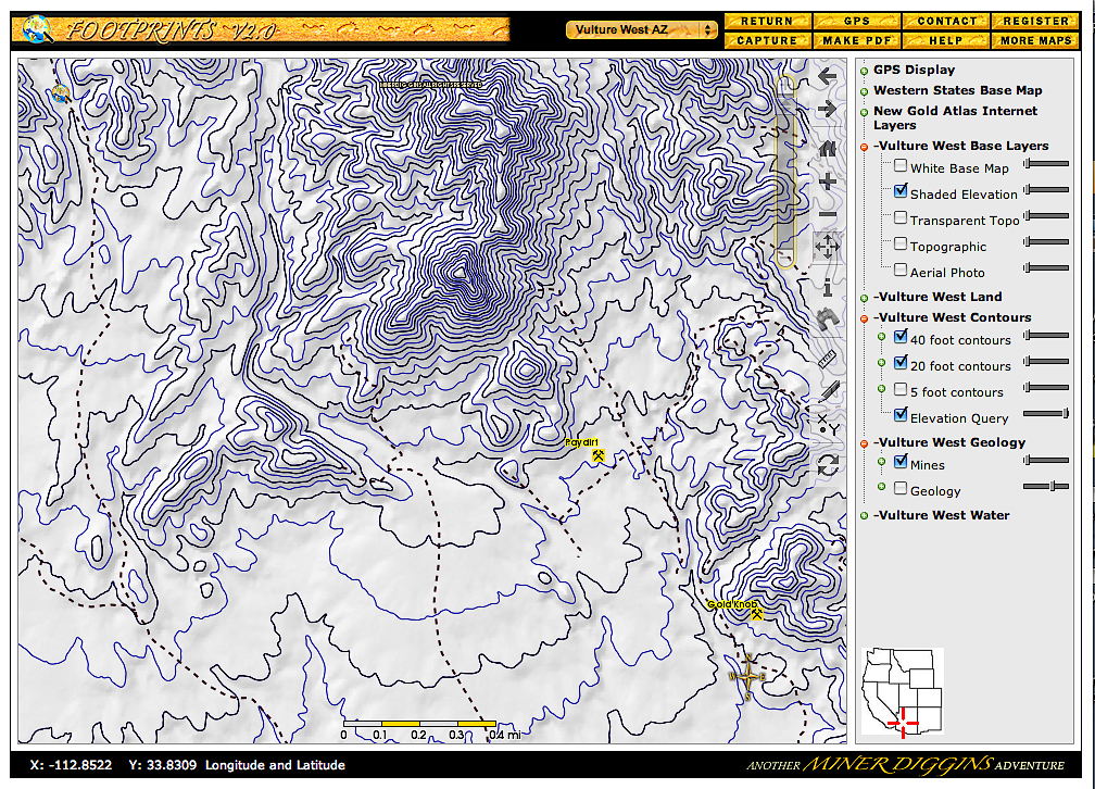
Click on the Image above to see a larger sized image in a new window. The larger image produced is between 600 and 900kb in size and is an average resolution for the image produced by the FootPrints application. Larger or higher resolution monitors produce larger images. Single map images exceeding 5 Mb in size are not unusual. The FootPrints V2 interface allows you to size your mapping window to fit your needs. Full screen, small enough to allow multiple windows or anywhere in between the choice is yours. |
This Mapview shows an example of contour mapping on the Vulture West FootPrint. Contour Maps help us to visualize the terrain of an area, tricking our eyes into seeing things in 3D. The Contour layers are unique and created by Miner Diggins specifically for the Vulture West FootPrint.
In this example we have selected the following layers;
At this zoom level, 20 ft and 40 ft Contours layers are used to visualize the terrain. At a higher zoom level adding 5 ft Contours would be appropriate. These Contour layers can be applied over any base map. By overlaying contours on an Ortho we can see the actual terrain in 3D. A Compass and Scale bar appear on each map displayed and printed. |
|---|