| FULL EXTENT OF MAP AREA
|
|---|
Click on the Image above to see a larger sized image in a new window. The larger image produced is approximately 466 kb in size and is lower resolution than the image produced by the FootPrints application. |
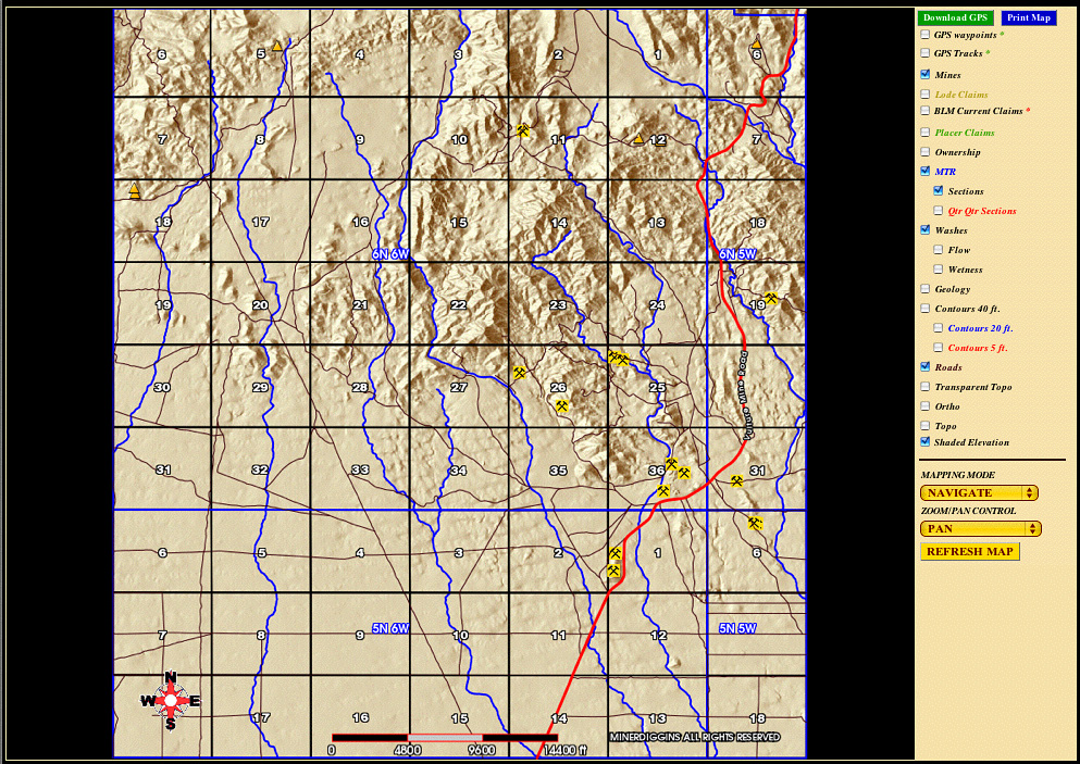
This Mapview shows the full extent of the area mapped in the Vulture West FootPrint.
This FootPrint covers the western half of the Vulture Mountains, west of and including the Vulture Mine. Approximately 65 Square Miles.
On the right side of the screen is a list of all layers that can be displayed on your map. In this example, we have selected these layers:
As you zoom into the map, more details will appear. You will begin to see Mine names and Wash names. By switching to Information Mode you may query the map to display the MRDS data for each mine. The MRDS is the USGS Mineral Resources Data System which catalogs known mines. This includes information such as commodity mined, previous mine names, references and much more.
|
|---|