| MAP QUERY
|
|---|
Click on the Image above to see a larger sized image in a new window. The larger image produced is approximately 288 kb in size and is lower resolution than the image produced by the FootPrints application. |
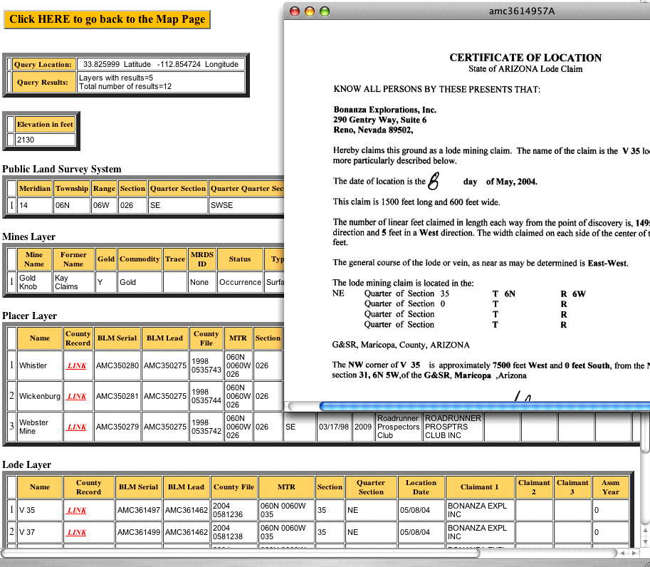
Click anywhere on the map in Information Mode and retrieve results from our extensive database. Every query will return these basics.
When in Information Mode, clicking on the map will return database information for all active map layers. The further the map is zoomed in the more specific the results of the query will be. Claims Database Includes;
Other Database Information
|
|---|