| ORTHOGRAPHIC ZOOM
|
|---|
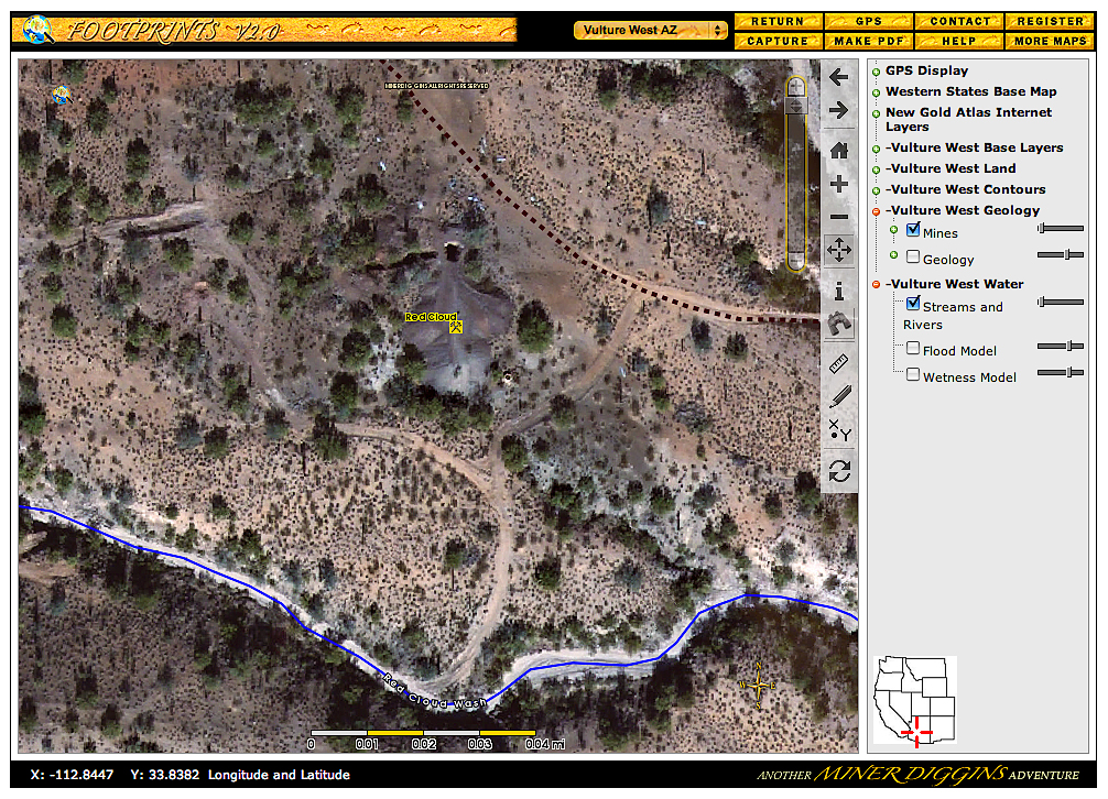
Click on the Image above to see a larger sized image in a new window. The larger image produced is between 600 and 900kb in size and is an average resolution for the image produced by the FootPrints application. Larger or higher resolution monitors produce larger images. Single map images exceeding 5 Mb in size are not unusual. The FootPrints V2 interface allows you to size your mapping window to fit your needs. Full screen, small enough to allow multiple windows or anywhere in between the choice is yours. |
This
sample shows an Orthographic Zoom with Mines, Roads, and Washes displayed.
Ortho-rectified High Resolution Imagery gives you a birds eye view of the entire Vulture West FootPrint.
Personal GPS Tracks and Waypoints can be recorded on your GPS unit, downloaded using FootPrints software and displayed over the Ortho. Use this to map your finds or the path to your favorite location. All layers except the shaded elevation layer may be draped over the Ortho and viewed at any Zoom Level.
|
|---|