We search for any studies,
reports and maps that have been done on the area. If the data
is useful to the prospector, we will map it and provide a
full digital copy (pdf) with the FootPrint.
We map Geologic Studies, Historical Placers
and any other information that will help you find the Gold.
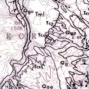
Original Report at Full Zoom Level
FootPrints Map
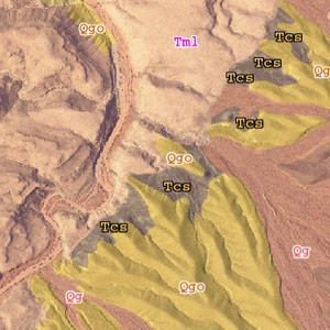
Geology over Aerial Imagery
You can still Zoom into the Map Several Times
for More Detail.
Information Mode will Display the Full Geology Database.
Remember, each FootPrint is completely Geo-Rectified.
Click on any point to get geographic coordinates. Pop them
into your GPS and they can lead you right to the X on the
map.