|
The Information Mode on
any FootPrint
will display the following basic information for
any point on the the map that you CLICK.
Latitiude and Longitude
Coordinates
Elevation
Meridian, Township, Range and Section
USGS Quad Map Name
Along with standard information,
the program will display any detailed information available
for each layer that is "checked".
In this Gold Basin example,
the Mines Layer will return mines information from Professional
Paper 1361 into a database table.
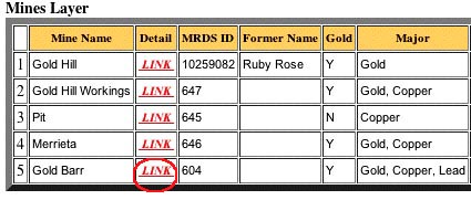
Clicking the "Link"
button will open a new window that displays data about that
specific site, directly from PP 1361. Here I have selected
site # 604.
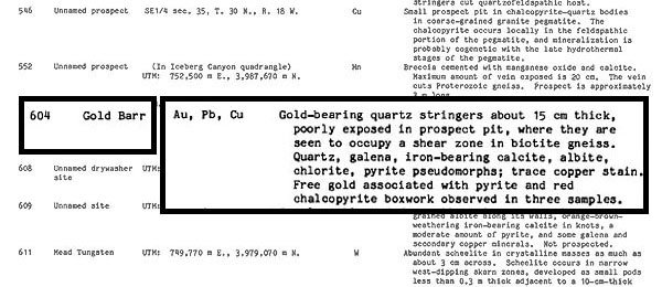
With a few SIMPLE
clicks, you know that you are looking for "Gold-bearing
quartz stringers about 15 cm thick" at the site selected
!
No more sifting through pages of indexes, tables
and maps...just to get to the detailed information you need
to know!
And of course, the entire USGS Report, "Professional
Paper 1361" is included in the FootPrint for your comprehensive
study.
|