|
This is a zoomed in image
of the same area on the Gold Basin FootPrint. Now you can
visualize these points in relationship to the other map layers.
In this image I have selected
the following layers to display on the map.
Mines
Aerial Imagery (Ortho)
20 ft Contours
Geology
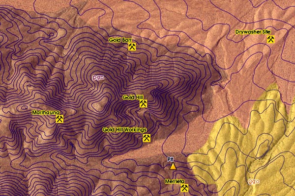
Now we have a map that
tells us:
The Site Name.
The Terrain.
The Geologic Nature.
By Adding other Standard
Map Layers, we could answer the following questions;
How do I get there (roads)
Who owns the Land? (ownership / patents)
Is there already a Claim here? (lode & placer claims)
What Township, Range and Section is it in? (mtrs)
How does the water flow in this area? (flow, wetness)
But Wait........There
is even More...
This layer also has a
database of information attached. By invoking the Information
Mode, you can CLICK on any point on the map to return more
information.
|